Description
Satellite measurements have provided unprecedented imagery coverage of the planet. Questions remain on how well these measurements match ground measurements. Having accurate and up to date maps of the global landcover and its climate feedback properties is important in running accurate GCM’s. Understanding how climate feedback mechanism behave under climate stresses is very important in developing accurate models.
Areas that are sensitive to climate changes or stresses are of particular interest because of climate change. It is predicted there will be increased occurrences of droughts, due in part from climate in the coming century. These droughts will have the largest impact on semi-arid areas. How droughts will affect changes in land cover, and most importantly the amount of growing land, is still poorly understood.
Preliminary Results
Presentations
- June 9th, 2010: presentation for surface heat budgets and climate meeting.
- July 7th, 2010: update presentation.
- Preliminary Results Presentation: Aug 11th
- Masters Defense_ Aaron Judah: Sept 10th
Useful links
- Zeng,N.,and J.Yoon. 2009. Expansion of the world’s deserts due to vegetation albedo feedback under global warming. Geophys.Res.Lett., 36, L17401,doi:10.1029/2009GL039699.
- Liang, S., A. H. Strahler, and C. W. Walthall. 1999. Retrieval of land surface albedofrom satellite observations: A simulation study. J. Appl. Meteorol., 38: 712-725.
- Tamara Machac. Master Thesis. Satellite Contributions to Surface Heat Budget Estimates: A Study of 4 Ameriflux Sites in Southern California.
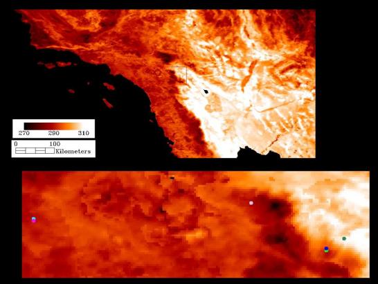
Flux Tower Region of Interest
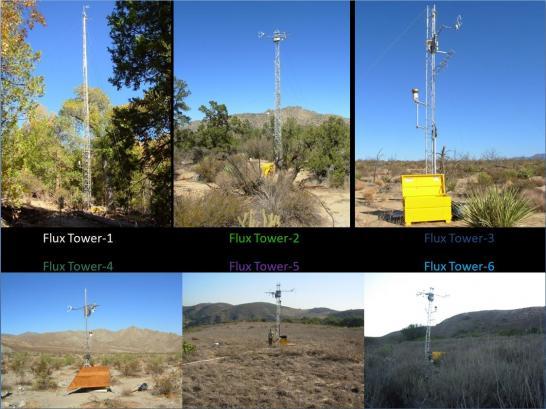
Flux Towers Sites